
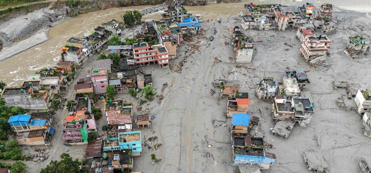
When the ice-rock avalanche collapsed from Langtang Lirung on the morning of 26 August 2026, the physical shockwave did not stop at the riverbanks of Rasuwa. It systematically struck at the twin economic pillars sustaining modern Nepal: national electricity generation and northern cross-border trade. In less than a day, a single mountain drainage corridor transformed from a strategic industrial artery into a multi-billion-dollar zone of paralysis.
The energy sector suffered an immediate, crushing blow. The surge tore through 14 hydropower projects along the Bhote Koshi and Trishuli basins, affecting a staggering 748 MW of capacity across nine operating plants and five under active construction. Plants like Upper Trishuli 3A, Chilime, and Rasuwagadhi were caught directly in the path of the slurry. With approximately 431 MW knocked off the national grid within hours—representing roughly 10 percent of Nepal’s entire generating capacity—the disaster exposed the severe vulnerability of centralizing energy assets inside narrow, high-velocity glacial riverbeds. The total destruction of the Trishuli 220 kV 3B Hub Substation, coupled with six snapped transmission corridors, effectively severed high-voltage evacuation routes and left the national power grid scrambling to avert wider outages.
Simultaneously, the deluge severed Nepal’s primary commercial gateway to China. The Rasuwagadhi–Gyirong corridor was knocked offline almost instantly as the flood pulverized the dry port, flattened border facilities, and left customs officials unaccounted for. Along the critical Betrawati–Rasuwagadhi highway, an estimated 42 kilometers of roadbed were either washed out or buried, alongside the complete destruction of 68 bridges—35 motorable and 33 suspension. Transport fleets carrying cargo, construction machinery, and local commerce were stranded or crushed. Further downstream, key highway links like Krishnavir along the Prithvi Highway buckled under the river’s fury, cutting off the main logistical lifeline that feeds Kathmandu and neighboring commercial centers.
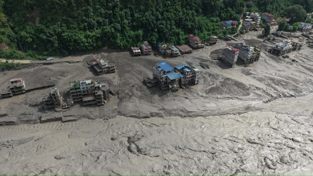
Beyond physical infrastructure, the socio-economic machinery vanished into the mud. In towns like Timure, Syaphrubesi, and Betrawati, nine commercial bank branches were wiped out, stranding banking personnel and paralyzing local liquidity. The sudden closure of the Langtang trekking circuit left over 500 foreign trekkers stranded and instantly drained seasonal revenue from hoteliers, guides, and porters whose livelihoods depend entirely on autumn tourism.
With initial direct physical damages to roads, bridges, and energy assets pegged at roughly NPR 200 billion (around USD 1.3 to 1.5 billion), and comprehensive reconstruction needs projected at USD 4 to 5 billion, the disaster is a harsh reality check. This corridor was already recovering from a previous flood in July 2025, yet public assets and settlements were rebuilt in the very same high-risk flood paths. The Trishuli-Bhote Koshi disaster proves that rebuilding back the same way is an unsustainable gamble; unless hazard modeling and cryosphere science are embedded into how Nepal designs energy corridors and trade transit routes, the nation remains one slope failure away from economic paralysis. f