
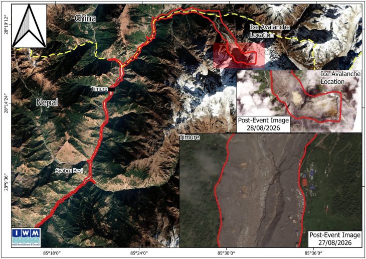
On August 26, 2026, Rasuwa District, Nepal, was struck by a powerful outburst flood, a devastating reminder of the challenges in our mountain regions. This event, triggered by an ice avalanche near Timure, sent a torrent down the Bhote Koshi River. The scale of the impact has been captured and analyzed by international and national Earth Observation programs, and these satellite maps provide critical insights for understanding the event and coordinating response.
The initial view identifies the general path, tracing the red line from the ‘Ice Avalanche Location’ above Timure, down past Syabru Besi. Post-event images from August 27th and 28th show the dramatic changes to the riverbed.
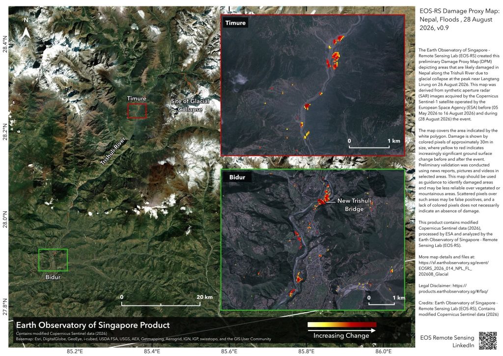
A key analysis from the Earth Observatory of Singapore uses a ‘Damage Proxy Map’. This map highlights ground surface changes, with a heat map from yellow to red showing increasing damage. It points to critical infrastructure impacts, including damage at the ‘New Trishuli Bridge’ downstream.
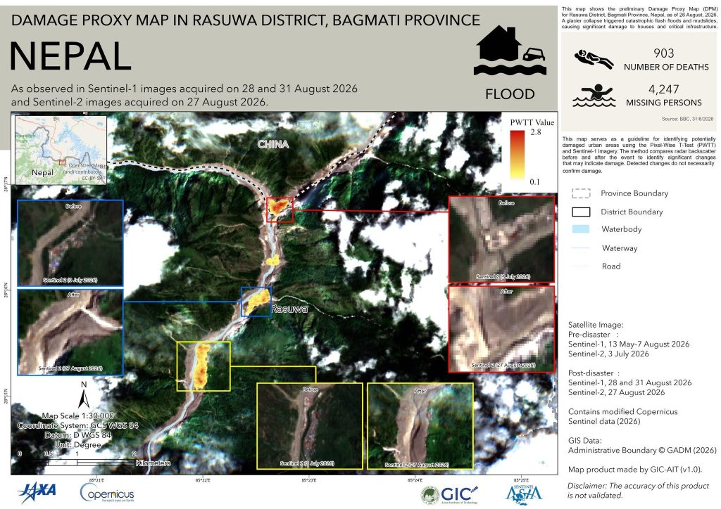
A detailed summary from GIC-AIT is a stark representation of the human and infrastructural toll, citing 903 deaths and over 4,200 missing. Their damage proxy map, alongside before-and-after satellite views, shows extensive damage to the waterway and roads.
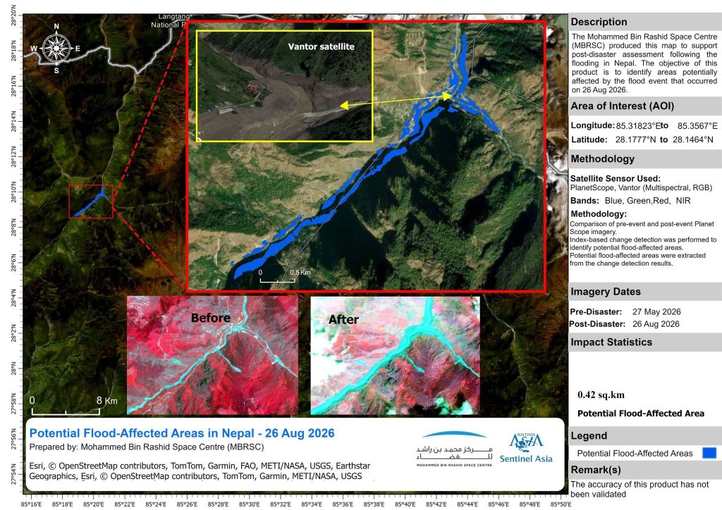
Further assessment by the Mohammed Bin Rashid Space Centre through Sentinel Asia focuses on specific points of interest. It highlights the vast area affected by comparing pre-and-post-event satellite imagery, quantifying the impact with concrete statistics like a potential 0.42 sq.km affected area near a specific monitoring site.
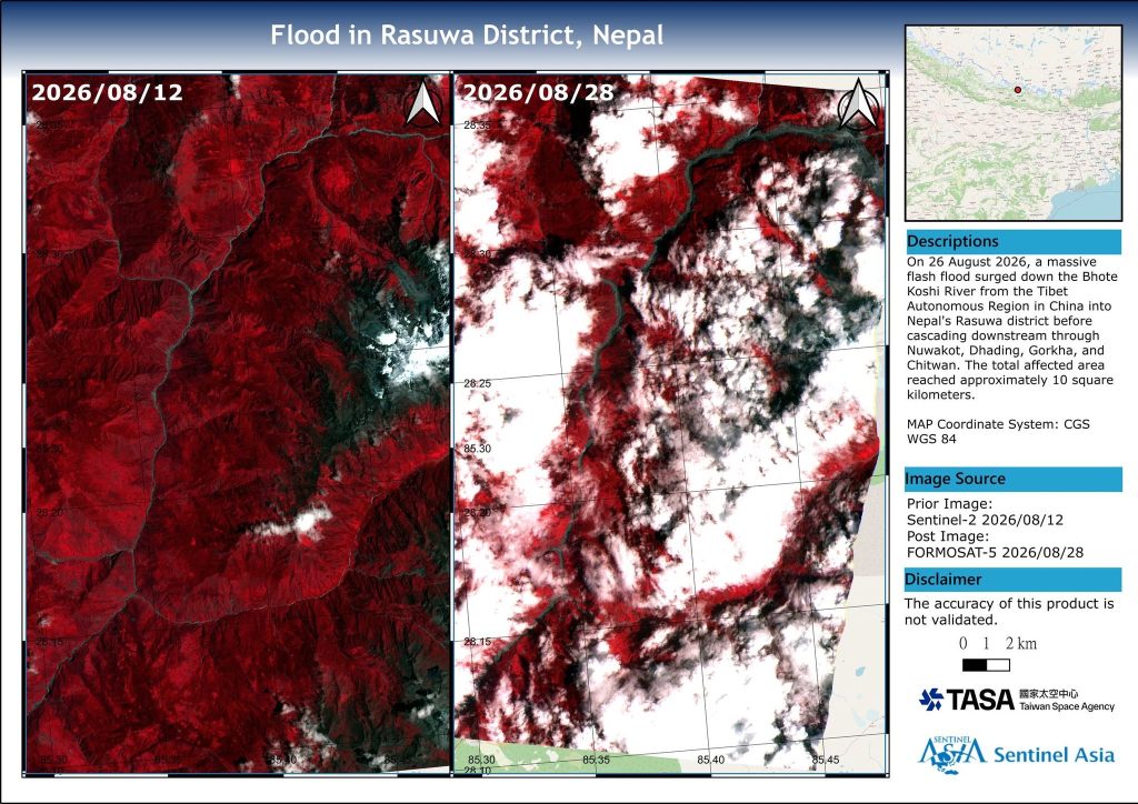
Finally, a visualization from TASA and Sentinel Asia uses false-color composites to contrast the ‘normal’ state in mid-August with the flooded area on August 28th. The dense white areas indicate the flood-affected zones and mud deposits covering previously vegetated land, showing a total affected area reaching approximately 10 square kilometers.
For a deeper understanding and ongoing discussion, these resources from international agencies like Copernicus, TASA, and Sentinel Asia are invaluable.