
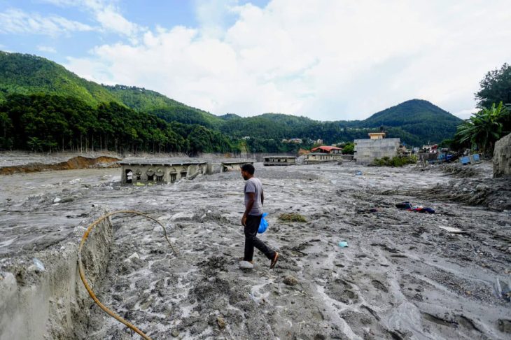
On the morning of 26 August 2026, a catastrophic wall of water and debris tore through northern Nepal’s Bhote Koshi corridor, leaving widespread devastation in its wake. While early speculation blamed a ruptured glacial lake, satellite analysis uncovered a far more terrifying origin: an unprecedented mass collapse on the northern flank of the Langtang-Lirung massif. To comprehend why this event wreaked such downstream destruction, one must examine the extraordinary physical scale, volume, and gravitational energy unleashed at the mountain’s source.
The catastrophe began high up at an elevation of approximately 5,200 meters above sea level. At 8:37 AM, a massive slab of hanging glacier and frozen bedrock violently broke away, plummeting 1,400 meters down to the 3,800-meter mark and slamming into the lower debris-covered glacier. This initial 1,400-meter vertical freefall alone dwarfs Angel Falls, the tallest waterfall on Earth. The colossal impact gouged out a deep depression that instantly formed a new 0.19-square-kilometer lake, simultaneously scouring and mobilizing vast amounts of secondary debris.
The combined torrent then plunged another 1,100 meters into the Lhende River gorge at 2,900 meters. Overall, the mass fell through a total vertical drop of 2,300 meters—nearly three times the entire height of Dubai’s Burj Khalifa and more than double the sheer rock face of Yosemite’s El Capitan.
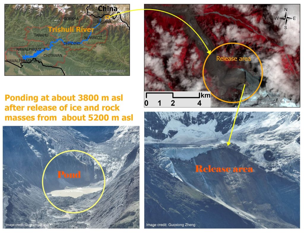
Source area in Gosaikunda Rural Municipality showing detachment at ~5,200 m and ponding at ~3,800 m (Image Credit: Guoxiong Zheng).
The sheer volume of mobilized earth defies ordinary comprehension. Satellite investigations mapped a 2.26-square-kilometer primary collapse zone averaging 50 meters in depth, alongside a 2.93-square-kilometer secondary erosion track. Together, they ripped away and mobilized over 142 million cubic meters of ice, rock, and sediment. To put that in perspective, this is equivalent to roughly 55 Great Pyramids of Giza or nearly 57,000 Olympic-sized swimming pools of solid mountain material surging down the slopes within minutes. The total disrupted footprint of 5.19 square kilometers is larger than New York City’s Central Park and more than two and a half times the area of the entire nation of Monaco.
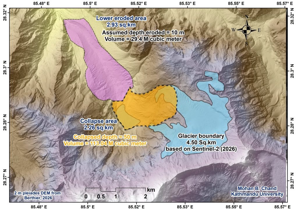
Detailed mapping of the 2.26 km² collapse zone and newly created 0.19 km² lake at the impact site
When this immense slurry crashed into the Lhende River, it temporarily choked the narrow gorge before bursting downstream with terrifying kinetic energy. The force of millions of tons slamming against the valley floor was so violent that seismic networks registered ground motion comparable to a local earthquake. Rocketing down the valley at speeds of 54 km/h (15 m/s), the slurry surged past Syaphrubesi with a peak discharge of roughly 23,000 cubic meters per second. That peak flow is nearly ten times the average discharge of Niagara Falls, crammed into a razor-thin Himalayan canyon.
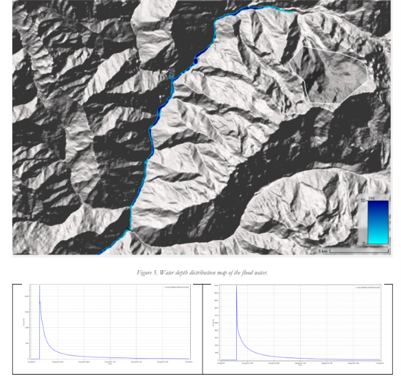
imulated hydrograph illustrating the massive 23,000 m³/s discharge peak recorded along the corridor
Crucially, this mega-flood occurred without any preceding heavy rainfall, highlighting that it was not a conventional weather-driven event. It was instead an explosive chain reaction of high-altitude rock destabilization, permafrost thaw, and glacial entrainment in a geologically fragile landscape. By converting massive gravitational potential energy across thousands of vertical meters into destructive fluid force, the Langtang-Lirung disaster serves as a sobering preview of how cryospheric hazards are evolving in the high Himalayas.
References:
-
Chand, M. B., Kayastha, R. B., Adhikari, S., Pokharel, A., Moktan, B., Bajracharya, H., Basnet, U., & Paudel, P. K. (2026). Rapid situation report: Bhotekoshi-Trishuli catastrophe. Jointly prepared by Youth Alliance for Environment (YAE), Himalayan Cryosphere, Climate and Disaster Research Center (HiCCDRC) – Kathmandu University (KU), and Society for Conservation Biology Nepal.