Category - Opinion

Mapping Disaster: A Satellite View of Rasuwa Flood

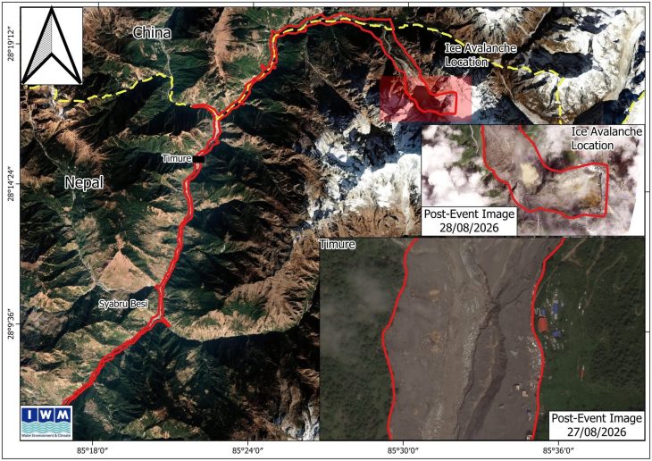
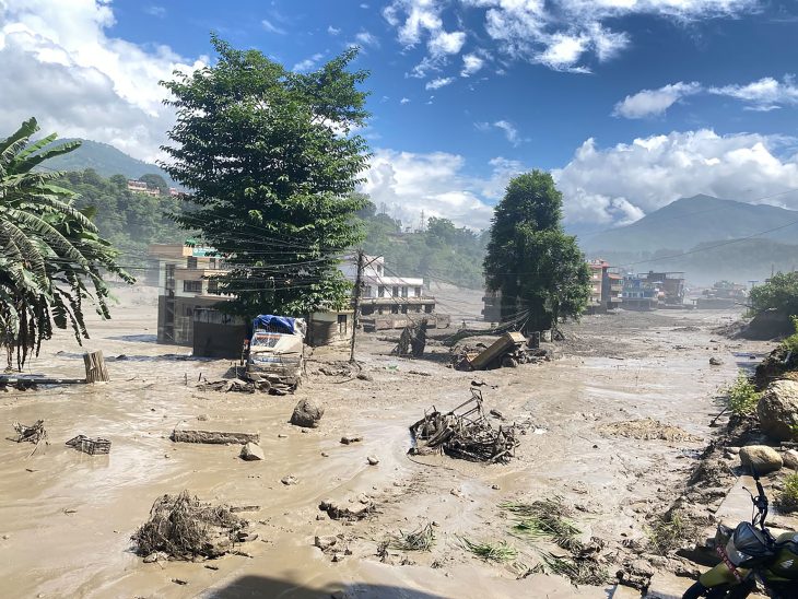
On August 26, 2026, Rasuwa District, Nepal, was struck by a powerful outburst flood, a devastating reminder of the challenges in our mountain regions. This event, triggered by an ice avalanche near Timure, sent a torrent down the Bhote Koshi River. The scale of the impact has been captured and analyzed by international and national Earth Observation programs, and these satellite maps provide critical insights for understanding the event and coordinating response.

The initial view identifies the general path, tracing the red line from the ‘Ice Avalanche Location’ above Timure, down past Syabru Besi. Post-event images from August 27th and 28th show the dramatic changes to the riverbed.

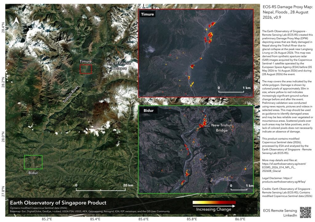
A key analysis from the Earth Observatory of Singapore uses a ‘Damage Proxy Map’.  This map highlights ground surface changes, with a heat map from yellow to red showing increasing damage. It points to critical infrastructure impacts, including damage at the ‘New Trishuli Bridge’ downstream.

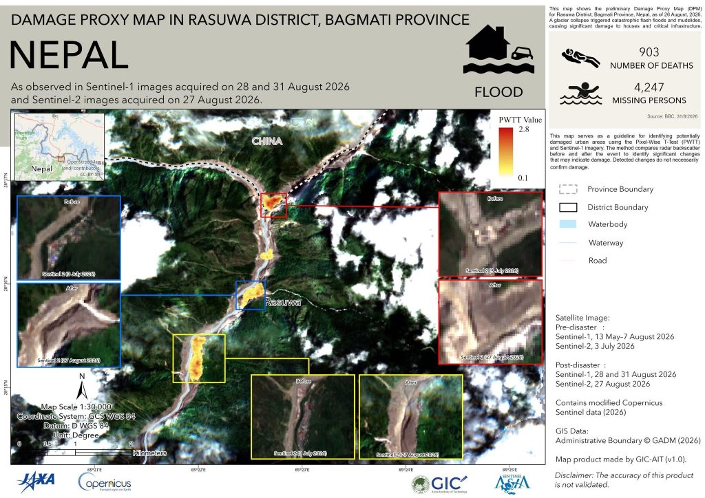
A detailed summary from GIC-AIT is a stark representation of the human and infrastructural toll, citing 903 deaths and over 4,200 missing. Their damage proxy map, alongside before-and-after satellite views, shows extensive damage to the waterway and roads.

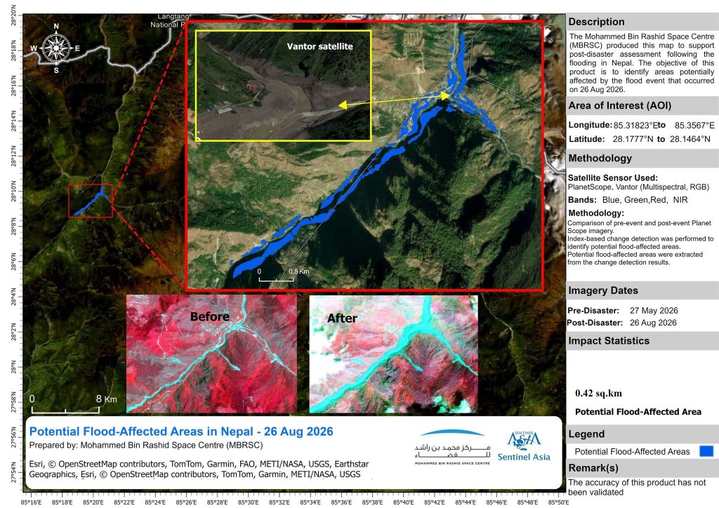
Further assessment by the Mohammed Bin Rashid Space Centre  through Sentinel Asia focuses on specific points of interest. It highlights the vast area affected by comparing pre-and-post-event satellite imagery, quantifying the impact with concrete statistics like a potential 0.42 sq.km affected area near a specific monitoring site.

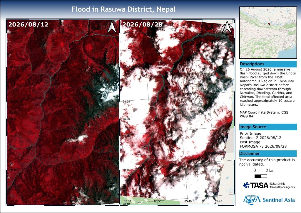
Finally, a visualization from TASA and Sentinel Asia  uses false-color composites to contrast the ‘normal’ state in mid-August with the flooded area on August 28th. The dense white areas indicate the flood-affected zones and mud deposits covering previously vegetated land, showing a total affected area reaching approximately 10 square kilometers.

For a deeper understanding and ongoing discussion, these resources from international agencies like Copernicus, TASA, and Sentinel Asia are invaluable.

Why Glaciology Must Become a Pillar of National Security

The catastrophic flash flood that recently tore through the Rasuwa corridor along the Bhote Koshi basin has left behind an unimaginable trail of human grief and infrastructural ruin. Critical state infrastructure—including the Miteri Bridge, the Rasuwa customs checkpoint, the NPR 2.8 billion dry port, nearly 440 MW of hydropower facilities, and Nuwakot’s 25 MW solar plant—was either severely damaged or washed away within hours.

While early reports speculated a traditional Glacial Lake Outburst Flood (GLOF), subsequent satellite investigations revealed a far more complex trigger: a massive avalanche and detachment of frozen bedrock and glacier from the northern flank of the Langtang Lirung massif at an elevation near 5,200 meters. Falling into the upper reaches of the Lhende River, this colossal mass of rock, ice, and debris formed a temporary dam that breached catastrophically. The resulting hyper-concentrated debris flow accelerated down the gorge at an estimated 54 km/h, reaching a peak discharge of roughly 23,000 m³/s at Syaphrubesi—engulfing multi-story structures in barely 30 minutes.

“This disaster—nothing short of an inland ‘Himalayan Tsunami’—is a sobering wake-up call. Glaciology is no longer an academic curiosity for lecture halls; it must be treated as an essential defense and national security doctrine.”

1. The Vulnerability of a Fragile Landscape

Nepal sits squarely along the youngest and most tectonically dynamic mountain system in the world. The legacy of the 2015 Gorkha earthquake left steep slopes heavily fractured. At the same time, haphazard infrastructure development, unengineered hillside cuts, and accelerating climate change have compounded this structural vulnerability.

Nepal harbors over 2,000 glacial lakes, with at least 21 identified as critically dangerous. Yet, as the Langtang Lirung event demonstrated, risks are not limited to moraine-dammed lakes. Hanging ice walls, degrading permafrost, rock-ice avalanches, and cascade damming in inaccessible gorges pose an existential threat downstream.

2. The Economic & Strategic Shock

For an economy striving for consistent growth, a single mountain surge can wipe out billions in strategic capital within minutes. Nepal produces less than 0.1% of global greenhouse emissions, yet our communities and clean-energy corridors bear the heaviest burden. Hydropower forms the backbone of Nepal’s domestic energy security and export revenue, but virtually all major powerhouses and transmission lines sit in deep, narrow valleys directly downstream from melting glaciers.

Our national disaster paradigm remains largely reactive: mobilizing state resources for search, rescue, and post-disaster compensation, while chronically underinvesting in early hazard intelligence and preventive design.

3. Modernizing Defense: Integrating Geospatial Intelligence (GEOINT)

Regional defense establishments have already adapted to these realities. India consolidated high-altitude cryosphere surveillance under defense research wings (such as DRDO’s DGRE) to secure border infrastructure. Pakistan’s space agency (SUPARCO) maintains constant orbital monitoring over high-risk Karakoram glaciers.

Nepal must urgently modernize its own operational security. The disaster management wings of the Nepali Army (NA) and the Armed Police Force (APF) need direct access to dedicated Geospatial Intelligence (GEOINT) capabilities.

During the monsoon, optical satellites are blinded by dense cloud cover. However, modern Earth observation technologies—specifically Interferometric Synthetic Aperture Radar (InSAR) and LiDAR—can see through clouds day and night to detect subtle slope creep, expanding glacial dams, and ground subsidence well before an outburst occurs.


The Strategic Roadmap Ahead

  • High-Altitude Cryosphere Surveillance Unit: Establish an integrated command center linking glaciologists, geologists, national security apparatus, and GIS specialists to monitor sensitive glacial basins in real time.
  • Early Warning Networks: Deploy upstream automated radar water-level gauges and acoustic sensors tied directly to automated sirens and downstream community alerts.
  • Climate-Resilient Engineering: Re-evaluate river basin master plans. Mandate that major infrastructure and hydropower installations be designed to withstand high-velocity debris flows, not just legacy rainfall models.
  • Update National Security Doctrine: Formally expand Nepal’s defense priorities from traditional borders to include ecological, hydrological, and cryospheric threats.

The Eels of My Childhood

I recently read Prabesh Khatiwada’s long feature story on Onlinekhabar titled ‘बाम माछाको रहस्यमय जीवन : नदीका पाहुना, समुद्रका सन्तान’ (The Mysterious Life of the Eel Fish: Guest of the River, Children of the Sea). The title immediately stirred vivid memories of my childhood. Well and nicely articulated by Mr. Prabesh Khatiwada ji. Reading this story felt like reading a deeply resonant piece written by Setopati’s Sudeep Shrestha.

This article gave me a wave of nostalgia that swept over my hometown. I had never previously gone deep into the biology of this fish. From his article, I came to know that this creature is born in the deep saltwaters of the Indian Ocean, traveling thousands of kilometers upstream into inland rivers, only to return back to the ocean decades later to spawn and die.

Reading it brought me straight back to the late 1990s and early 2000s in my home village of Urlabari, Morang.

Back then, I knew nothing about the Atlantic or the Bay of Bengal, nor did I realize that the mysterious, slender fish swimming in our local streams were oceanic travelers. To us kids, the muddy banks of Solti Khola and the surrounding wetlands were simply our playground.


मोरङको बेलबारी नगरपालिकास्थित बजारमा बिक्रीका लागि राखिएको बाममाछा । हेर्दा सर्प जस्तो देखिने बाममाछा यहाँ प्रति किलो रू एक हजारमा खरिदबिक्री हुने गरेको छ । तस्बिर : मणिराम दाहाल/ रासस


Chasing Kaichi Baam with a Balchi

During the monsoon, the landscape around Urlabari transformed. Swampy peatlands flooded, and the river system connecting Solti Khola to the Bakraha River came alive. Equipped with a simple Balchi—a curved hook baited with earthworms and tied to a string and rod—my friends, my brother, and I would head out for swimming and fishing.

Navigating those marshlands wasn’t without its thrills and fears. We treaded carefully, always terrified of encountering the Vyatlung. Vyatlung used to be a mysterious, leech-like swamp creature that lurked in the mud. But the ultimate reward was catching a Kaichi Baam—the slender, scissor-like variant of the eel that hid deep inside underwater burrows. On other days, we would also come across the Andha Baam embedded in the marsh.

“Navigating those marshlands was not without its thrills and fears. We treaded carefully, always terrified of encountering the Vyatlung lurking deep in the mud.”

Whenever I slipped home covered in mud, my mother would scold me for wandering off to the river. What she saw as a dangerous childhood habit was, for us, an irreplaceable thrill. Finding a small Baam in the flowing river was rare, which made every catch in those muddy rivulets feel like uncovering a hidden treasure.


A Symphony of Soil, Simsaag, and Eels

Looking back, those floodplains were the economic and ecological lifeblood of our village. Monsoon floods brought down rich topsoil from upstream, forming fertile floodplains and small rivulets along the riverbanks. In the fertile topsoil of those small rivulets, local farmers cultivated Simsaag (watercress). These Simsaag beds provided an alternative source of income for their families.

That soft, nutrient-rich mud under the Simsaag beds became the ideal sanctuary and home for young Baam Machha to feed, hide, and grow.

“It was a perfect ecological loop: the river brought the fertile soil, Simsaag was grown in that floodplain, and the muddy rivulets sheltered the oceanic guests.”


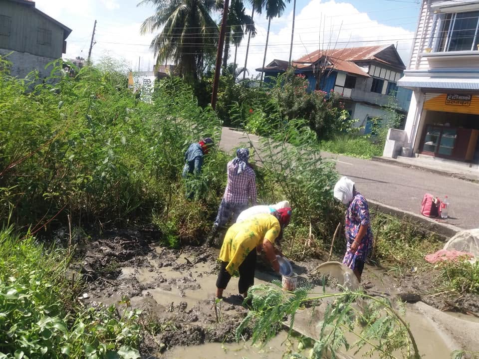
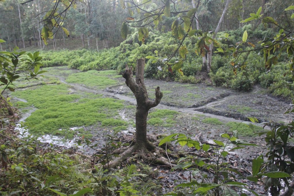
A view of a wetland area in Urlabari with muddy banks, natural vegetation, cultivated Simsaag beds. I took this photo during my graduate field study.


What Was Once a Haven Is Now Under Threat

As Khatiwada’s article reminds us, the Baam Machha is a guest in our rivers. But over the years, we have made our rivers hostile hosts.

Even during my childhood, destructive practices were beginning to creep in. I remember seeing people place chemicals and poisons near bridges and embankments to catch fish easily. In the decades since, wetland drainage, riverbed degradation, and water pollution have broken the natural connectivity between our local streams like Solti Khola and the larger ocean systems beyond.

When we destroy a swampy rivulet in my village, we lose much more than a local fishing spot. We are severing a link in a grand, global migration that has existed for millions of years. The wetlands and marshy lands where we used to fish are now filled with concrete houses.


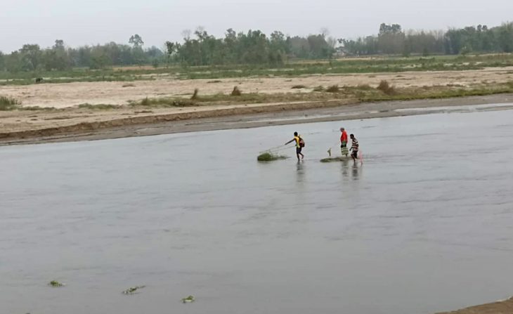
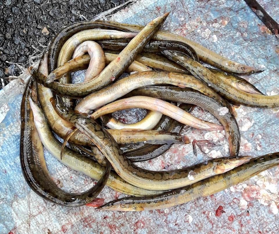
An eel caught in local riverwaters, showing the Kaichi Baam.


Reclaiming the Memory, Protecting the Future

Reading about the biology of the Baam fish has transformed my childhood memories. This story turned my simple nostalgia into a deep appreciation for ecological connectedness. The tiny Kaichi Baam and Andha Baam I pulled from the mud near Solti Khola had navigated an extraordinary, heroic journey across oceans and river networks just to reach our village.

Our local wetlands in the Tarai are precious. If we want future generations in places like Urlabari to experience the wonder of these river guests, we must protect our peatlands, stop destructive fishing practices, and keep our rivers free-flowing.

The next time you see a Baam fish, remember: it carries the mystery of the deep sea right to our backyard.

What’s Next for Nepal’s Tigers ?

By Gobinda Prasad Pokharel
Published: July 29, 2026 (Global Tiger Day)

The Milestone We Celebrate

Today, as the global conservation community marks Global Tiger Day 2026, Nepal stands out as a world leader in carnivore recovery. Having successfully achieved the milestone of more than doubling our wild tiger population expanding from 121 in 2010 to 355 in 2022 our landscape strategy enters a new chapter.

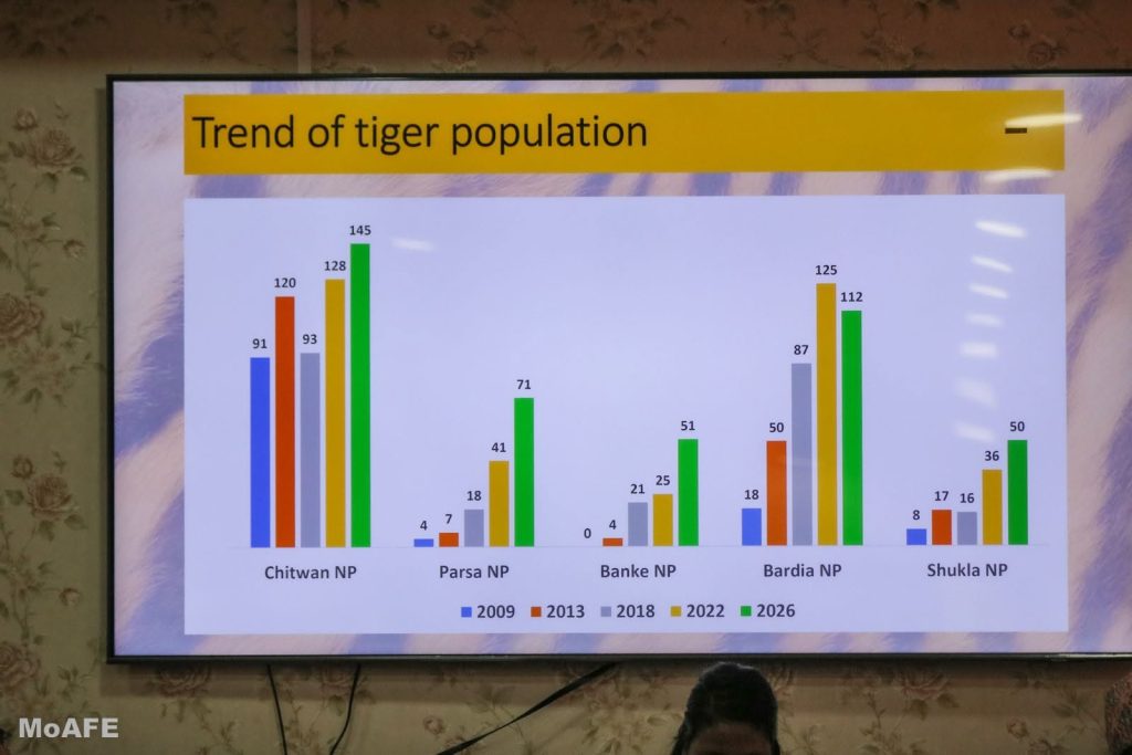
Preliminary Tiger Estimates: 429 Total

Population Estimates Across Protected Complexes

145
CHITWAN
112
BARDIA
71
PARSA
51
BANKE
50
SHUKLAPHANTA

This growth—particularly the surge in satellite complexes like Parsa (71) and Banke (51) reflects years of frontline conservation activities including enforcement, habitat restoration, working with the community and the buffer-zone, and landscape connectivity.

Rethinking the Narrative: Carrying Capacity vs. Spatial Distribution

A prevalent narrative suggests that Nepal’s core national parks have reached their maximum biological carrying capacity, leading directly to human-tiger conflict. However, ecological evidence presents a more reality.

While Bardia records densities exceeding 7 tigers per 100 km² and Chitwan supports over 4 per 100 km², these densities remain below high-density reserves in India (such as Kaziranga or Corbett, which host over 13–14 tigers per 100 km²). Scientific assessments indicate that with continued prey restoration and habitat enhancement, Nepal’s forests can sustainably support over 400 wild tigers.

The major challenge is spatial distribution  rather than absolute overcrowding. Concentrated prey pockets create localized territorial competition, forcing older, injured, or young dispersing tigers toward park fringes and human-dominated buffer zones.

Field studies show that fewer than 5% of tigers in protected areas are ever involved in conflicts with humans. However, even isolated incidents carry serious social consequences, threatening public support for decades of conservation efforts.

The Shifting Geography: Tigers Head Upland

Climate change and shifting ecological dynamics are altering habitat ranges across Nepal. Recent studies project up to an 80% potential expansion of tiger habitats outside formal protected areas, with animals dispersing along historical corridors into the Chure, Mahabharat, and mid-hill community forests.(Read more in this link )

From documented presences in Dadeldhura and Ilam to recent documentations in Saptari near Koshi Tappu, tigers are actively searching out new territory. Managing these emerging habitats outside core Protected Areas will require institutional strengthening for Divisional Forest Offices and local Community Forest User Groups (CFUGs).

Embracing ‘Tiger Diplomacy’ and Proactive Co-existence

Sustaining Nepal’s wildlife achievements requires shifting focus from pure numbers to coexistence and international partnership [As we mentioned in Oped at Kantipur Daily and Republica Daily ]:

  • Leveraging ‘Tiger Diplomacy’ as Soft Power: Nepal’s conservation record provides a diplomatic framework for international collaboration, transboundary landscape preservation, and green funding opportunities.
  • Early Warning and Monitoring: Deploying AI-assisted camera traps, satellite telemetry, and rapid-response alerts helps identify dispersing or high risk animals before encounters occur.
  • Community Stewardship: Conservation is only sustainable when local communities feel safe and benefit directly. Reducing forest reliance through alternative livelihoods and ensuring prompt relief funding are essential pillars for long-term survival.

The success of wild tiger conservation in the coming decade will be judged not just by population figures, but by how safely people and tigers coexist across shared ecosystems.

A 200-Year Old Museum Specimen Just Rewrote Nepal’s Pangolin Story

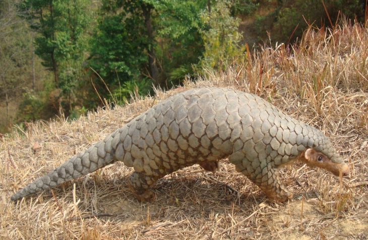
A team led by researcher Narayan Koju of Pokhara University has shown, through genetic analysis, that Nepal’s pangolin is not the same species as the Chinese pangolin found in China and Southeast Asia.

It’s a distinct species now being called the Himalayan pangolin (Manis aurita), found across Nepal, Bhutan, northeastern India, and southern Tibet. The findings were published in Communications Biology, a journal from the Nature group. Read More

Managing the Monkey Menace: How Do We Resolve the Human-Primate Conflict ?

From local villages to the halls of Parliament, the debate surrounding monkey management has once again taken center stage in national discourse. Communities bearing the brunt of monkey crop-raiding have voiced their grievances for a considerable duration. Even in the preceding parliamentary sessions, lawmakers put forward formal recommendations to the government regarding the mitigation of conflicts involving monkeys and other wildlife. Primate researchers, administrative enforcement bodies, and state departments have routinely submitted both written and verbal advisory frameworks to the executive branch. Yet, effective resolution strategies continue to falter.

Most recently, the Ministry of Forests and Environment constituted a technical committee comprising representatives from the Ministry of Agriculture and the Ministry of Home Affairs to mitigate agricultural losses driven by monkeys. Prior to this, the National Concern and Coordination Committee—which includes members from the Federal Parliament and National Assembly—produced a comprehensive field study report detailing the state of human-wildlife conflict. The diagnostic conclusions across nearly all these studies are remarkably uniform: prioritizing both short-term and long-term socio-ecological impacts remains paramount.

During a recent House of Representatives session, lawmaker and former minister Mahabir Pun asserted that entirely eliminating monkey-related conflict is an insurmountable challenge. Claiming that historical countermeasures had universally collapsed, he noted that building a rocket is actually scientifically easier than finding a simple technology to chase away a monkey.

While the state has not been entirely devoid of attempts, vital questions persist: How should local municipalities be supported in resolving this crisis? Is the nation genuinely incapable, or are our institutional frameworks uniquely broken? These queries remain unanswered. In the mid-hill regions, the phenomenon of monkeys raiding maize crops is an ancestral grievance, tracing back generations. The fundamental disruption has always existed; the contemporary shift lies simply in the modern intensity and frequency of these occurrences.

“A 2009 report by the International Union for Conservation of Nature (IUCN) definitively concluded that there is no singular, absolute solution for managing conflict involving large primate species. Applying this reality to Nepal holds accurate across most contexts.”

Currently, our structural Achilles’ heel in primate management is a total deficit of institutional coordination. Merely capturing a troop of monkeys from one locality and abandoning them in another does not resolve the crisis. A few years ago, monkeys from the Jute Mills area in Biratnagar (the capital of Koshi Province) were rounded up and released into the Kanepokhari forest along the East-West Highway. Today, that exact highway stretch is terrorized by the relocated primate troops.

In attempting to resolve a localized issue, the authorities succeeded only in cultivating a new crisis elsewhere. This Morang exercise demonstrates that haphazard relocation merely shifts the geography of the problem rather than solving it. Relocation demands rigorous preliminary studies regarding carrying capacity, ecological baseline, and timing before execution.

Understanding the Primate Balance in Nepal

Nepal handles three distinct species of monkeys, each carrying a separate ecological status:

  • The Rhesus Macaque: Noted as ‘Least Concern’ on the global red list, yet acts as the primary source of agricultural and urban friction.
  • The Assamese Macaque: Categorized as ‘Near Threatened’ globally and strictly protected under federal environmental laws.
  • The Hanuman Langur: Spans four distinct sub-species, balancing between standard ecosystem populations and local vulnerabilities.
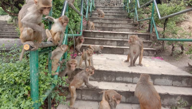
The ubiquitously visible species causing the highest degree of friction is the Rhesus Macaque. Its disruptive footprint spans the country. While agrarian communities endure the severest economic setbacks, they are not the sole victims. Pilgrims and religious sites are equally affected. In the Kathmandu Valley’s historical temples and shrines, primate troops routinely snatch ritual offerings, devotional items, and personal belongings from hundreds of visitors daily.

The Root Causes of Escalation

We cannot address the symptom without diagnosing the trigger. The baseline vectors include:

  • Systematic fragmentation and shrinking of native natural wildlife habitats.
  • Encroachment of dynamic farming properties direct up to forest lines.
  • The steady, unchecked drop in natural apex predators—specifically leopards—which traditionally balanced primate numbers naturally.
  • The steady availability of high-calorie human waste and deliberate feeding patterns.
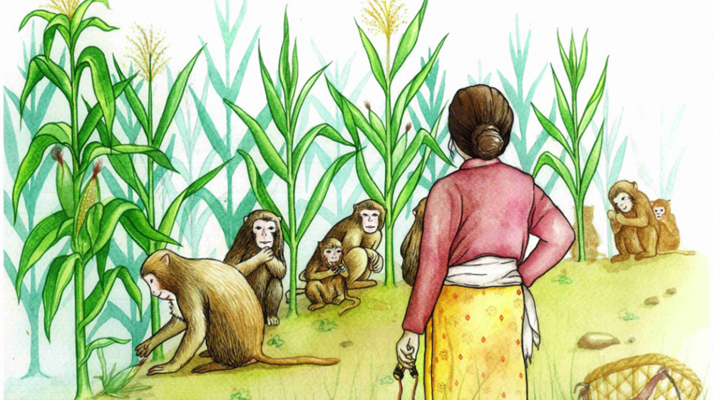
The principal driver drawing monkeys into human settlements is the availability of effortless sustenance. In many regions, this migration is fueled not by an absolute scarcity of forest food, but by the opportunistic preference for calorie-dense, cultivated crops that require minimal foraging energy. In semi-urban zones, the absence of standardized solid waste management provides an ongoing, abundant food source that supports artificial population bubbles.

Shifting to Site-Specific Solutions

The primary reason strategic measures collapse is that we treat all troops identically. Interventions require a clear geographical taxonomy. A dynamic farm raider operates under distinct natural logic compared to a religious site scavenger. Managing them requires three distinct operational avenues:

Conflict Context Primary Behavioral Pattern Strategic Focus
Agrarian Farms Driven by seasonal crops, entering field borders out of hunger. Mid-hill cultivation buffer zones
Heritage Shrines Habituated directly to human religious handouts and daily offerings. Kathmandu Valley cultural centers
Urban Markets Scavenging effectively on open waste platforms and municipal disposal areas. Townships and commercial centers

Tailoring interventions to these specific behavioral profiles yields authentic results. Strategic design can incorporate available acoustic technologies, co-existence frameworks, and structural habitat restoration. Crucially, inter-governmental synchronization across Federal, Provincial, and Local tiers is imperative. With a decentralized structure, clarity must be established regarding specific tasks down to the ward level. Additionally, real-time communication networks to track primate movement and report early crop damage are essential.

Actionable Frameworks: Tactical and Systemic

Sustainable management requires balancing immediate farm defense with clinical long-term stabilization tools.

Short-Term Farm Safeguards: Incorporating botanical defense strategies by cultivating highly non-preferred, pungent boundary crops—such as lemons, limes, turmeric, Sichuan pepper (Timur), or hot chilies. These alter the initial risk-to-reward ratio for scouting troops. Farms can also incorporate solar-powered electrical perimeter boundaries (adapted from elephant control measures) and deploy directional acoustic alerts replicating localized alpha distress warnings to split up moving troops.

Long-Term Population Management: For isolated, high-density environments like urban cultural shrines, strategic biological population limits offer the most humane solution. Targeted laparoscopic sterilization models—which proved effective under parallel ecological strains in Himachal Pradesh, India—work reliably alongside the use of immunocontraceptive options (like PZP).

The Dead Ends: Export Protocols and Culling

Public discourse frequently circles back to international export mechanisms for medical laboratories. In reality, this route is blocked by massive legal, ethical, and international diplomatic challenges. Historically, regional neighbors like India and Bangladesh handled massive primate export contracts. Between 1956 and 1978, India shipped approximately 120,000 rhesus macaques to western clinical centers. However, deep structural pushback on animal welfare rights forced a comprehensive, permanent ban in 1979. Re-activating these transport chains in the modern regulatory landscape remains completely out of reach.

Similarly, the option of state-sanctioned lethal control or “culling” hits a brick wall. A nation like Nepal, deeply anchored in cultural, spiritual, and Vedic structural history, cannot reconcilably evaluate the mass systematic extermination of a species deeply bound to holy and revered spiritual dynamics.

The Horizon of Coexistence

Ultimately, there is no absolute, hands-off scientific cure to erase human-macaque friction entirely. The strategic mindset must transform from ideas of total exclusion toward intelligent, landscape-led coexistence. By securing physical perimeters, standardizing local municipal waste streams, and deploying clean tracking networks directly down to individual village wards, communities can establish strong structural perimeters while successfully preserving the shared natural eco-system.

Translation of my original opinion column published in Kantipur Daily.

Link: https://ekantipur.com/opinion/2026/05/25/how-to-manage-human-ape-conflict-52-18.html

Space Technology is Nepal’s Next Frontier for Diplomacy

In my latest article for The Diplomat Nepal, I explore why space is no longer a luxury for developing nations ?  In this article I explored about the success of NepaliSat-1 and Munal. Embrace the $1.8 trillion global space market by 2035.

I argued that the reality of the 21st century is  space technology is the backbone of modern disaster resilience, climate monitoring and telecommunications.

Having followed our journey from the initial launch in 2019 to the current manufacturing of the RSMS-sat constellation, I believe our greatest strength lies in our soft power diplomacy.

Read More

नेपालका सिमसारको बिग्रँदो स्वास्थ्य

गोविन्द पोखरेल

हरेक वर्षको फेब्रुअरी २ तारिखका दिन विश्वव्यापी रूपमा सिमसार दिवस मनाइँदै आइएको छ । यो वर्ष सिमसार र परम्परागत ज्ञानमा आधरित नारा रहेको छ ।

नेपालको सिमसार नीति, २०६९ ले प्राकृतिक तथा कृत्रिम रूपमा पानी जमेर वा बगेर,अस्थायी वा स्थायी रुपमा बनेको दलदल क्षेत्रलाई सिमसार भनेर परिभाषित गरेको छ । सरल भाषामा भन्नुपर्दा सिमसारमा न पानी सुक्छ न त जमिन नै लुक्छ ।

Read More

The ‘Sleeping Giant’ of Nepal

Gobinda Prasad Pokharel

Today, a photograph released by the Rastriya Samachar Samiti (RSS) caught my eye. It was a captivating shot of Kumbhakarna Himal. Struck by its beauty, I found myself digging deeper into the story behind this peak. What I discovered was a fascinating blend of culture, mythology and mountaineering history that I felt compelled to share.

Read More

How Nepal Mastered Tiger Diplomacy

Gobinda Prasad Pokharel

When we think of diplomacy we usually picture suits, handshakes and conference rooms. But in Nepal, diplomacy has stripes.

I recently came across an article on Diplomat Nepal titled ‘The Roar of Nepal’s Tiger Diplomacy’. I couldn’t stop thinking about it. We often hear doom and gloom stories about endangered species, but Nepal is writing a different narrative one where conservation isn’t just about saving animals. It’s about national pride, international relations and economic survival.

Read More